|
THE ISLE OF WIGHT - NEEDLES LIGHTHOUSE
|
|||||||
|
HOME | BIOLOGY | FILMS | GEOGRAPHY | HISTORY | INDEX | MUSIC | THE BOAT | SOLAR BOATS | SPONSORS |
|||||||
|
In 1781 merchants and ship owners petitioned Trinity House for a lighthouse. They obtained a specification in January 1782 which directed that lights should be: "kept burning in the night season whereby seafaring men and mariners might take notice and avoid danger ..... and ships and other vessels of war might safely cruise during the night season in the British Channel."
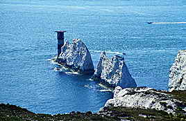
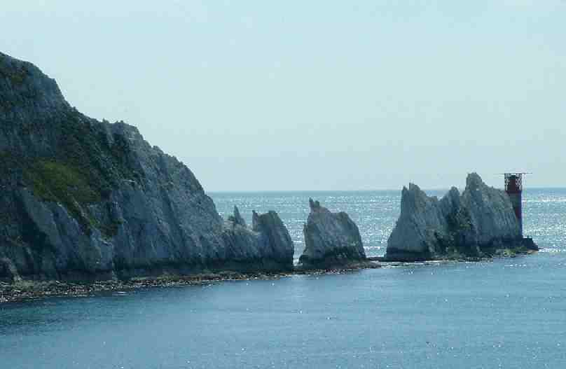
Set in the western approaches to the Isle of Wight, the Needles form a narrow chalky peninsula which rises from jagged rocks to 120m high cliffs. These rocks have always been a hazard to ships making their way up the Solent to Portmouth and Southampton Water.
St Catherine's Point: 50° 39'.70 N O1° 35,42 W
It was proposed that William Tatnall, or Tatsall, should (at his own expense) build the 1ighthouse, dwellings and necessary communications roads and provide keepers at the Needles, St. Catherine's Point and Hurst Point. All dues would go to Trinity House who in return would pay Tatnall £960 a year for 21 years. An alternative proposal was that Trinity House could build the lighthouse.
Negotiations took four years until 1785, during which Tatnall dropped out leaving Trinity House to erect the lighthouse. The chosen design was from R. Jupp, a former surveyor to the East India Company, from three locations at the Needles, St. Catherine's Point and Hurst Point. The Needles tower was illuminated on the 29th September !786. As the tower was situated on top of a cliff overhanging Scratehell's Bay, the light which was 144m above sea level was often obscured by sea mists and fogs and was therefore of limited use to mariners.
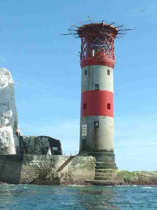
Consequently, in 1859 Trinity House planned a new lighthouse to be built on the outermost of the chalk rocks near sea level. It was designed by James Walker and cost £20,000. The circular granite tower has perpendicular sides and is 33.25mm high, of uniform diameter with an unevenly stepped base to break the waves mxd discourage sea sweeping up the tower. The wall varies from 1.07m in thickness at the entrance to 0.61m at the top. Much of the base rock was cut away to form the foundation. Cellars and storehouses were excavated in the chalk.
The Needles looking west
The light at the Needles has two white, two red and one green sector, with one of the red sectors intensified, these are set out as follows:
Eventually, the Needles Lighthouse was automated. Keepers left the lighthouse for the last time on 8th December 1994.
Needles was the last Trinity House lighthouse powered by 100V DC electricity from it's own generators. To enable the automation to be carried out, a mains power supply had to be laid on via a sub-sea cable from the Needles Battery. This provided standard single phase 240V AC power for the new equipment. A Helicopter pad was built onto the lighthouse to enable maintenance to be carried out quickly in emergencies.
The original optic with its arrangements of green and red glass giving the different sectors sectors of light remained after automation but a new three position lamps after was installed with two 1500W 240V main lamps and a 24 volt battery powered emergency lamp.
The Needles looking east
The supertyphon air driven foil: signal was replaced by two Honeywell ELG 500 Hz directional fog signals, controlled by means of a fog detector. The emitter stacks were mounted at gallery level outside the helicopter pad, structure. The Needles is now monitored and controlled via a cellphone telemetry link from the Trinity House Operations Control Centre at Harwich, Essex.
SUSSEX INDEX A - Z
BEACHY HEAD - BELL TOOT (BELLE TOUT) LIGHTHOUSE CHIDDINGLY - HORSE SHOW and GYMKHANA CUCKMERE VALLEY - EXCEAT EAST
SUSSEX HERSTMONCEUX - CASTLE - CE SCHOOL - LINKS - FESTIVAL TWISSELLS MILL, OLD HEATHFIELD
Nelson on the Isle of Wight ferry
A taste for adventure capitalists
Solar Cola - a healthier alternative
|
|||||||
|
This
website
is Copyright © 1999 & 2007 NJK. The bird |
|||||||
|
AUTOMOTIVE | BLUEBIRD | ELECTRIC CARS | ELECTRIC CYCLES | SOLAR CARS |